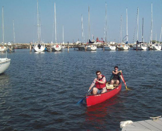
The Root River offers adventure for everyone. First-time and seasoned canoe and kayak enthusiasts will delight in this hidden gem. Depending on the season, the Root River can offer visitors a relaxing meander through parkland and urban settings, or provide a Class II+ challenge to even the most experienced kayakers.
In partnership with the City of Racine Parks, Rec, and Cultural Activities, the Root River Council has coordinated the installation of a canoe and kayak launch in Island Park. Additional public access can be found at Clayton Park, Rooney Boat Launch (south of Racine Yatch Club), and at the Root River Environmental Education Community Center (REC).
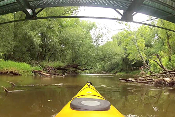
The Root River Pathway extends 4 miles from the Main Street Bridge in downtown Racine to the bird sanctuary: Colonial Park. The pathway is an ideal way to explore Racine by bicycle, skateboard, roller-blade, or foot. Tracing the banks of the Root River , the trail includes educational signposts that share the history ofthe Root and pragmatic ways residents and visitors can help preserve its natural habitat.
This unique perspective of Racine offers a bit of wilderness within City limits where open waters and riparian habitat offer space for the mind to roam. The Root River Pathway connects to the Lake Michigan Pathway at the Main Street Bridge with additional links to the Racine, Sturtevant, MRK, and North Shore trail networks.
In partnership with the City of Racine Parks, Rec, and Cultural Activities, the Root River Council has coordinated the installation of a canoe and kayak launch in Island Park. Additional public access can be found at Clayton Park, Rooney Boat Launch (south of Racine Yatch Club), and at the Root River Environmental Education Community Center (REC).
The Root River Pathway extends 4 miles from the Main Street Bridge in downtown Racine to the bird sanctuary: Colonial Park. The pathway is an ideal way to explore Racine by bicycle, skateboard, roller-blade, or foot. Tracing the banks of the Root River , the trail includes educational signposts that share the history ofthe Root and pragmatic ways residents and visitors can help preserve its natural habitat.
This unique perspective of Racine offers a bit of wilderness within City limits where open waters and riparian habitat offer space for the mind to roam. The Root River Pathway connects to the Lake Michigan Pathway at the Main Street Bridge with additional links to the Racine, Sturtevant, MRK, and North Shore trail networks.
|
|
Plan your next paddling trip with River Alliance of Wisconsin's interactive map!
Click HERE to get to the website. 
Click image for paddling safety tips
|
|
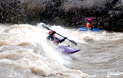
Quick Facts: Location: Northwest edge of city of Racine. Shuttle Length: 0.2-0.6 miles. Character: High tree-lined banks provide a ‘wilderness’ feel in a county park, where sloping bedrock creates fine playable features. Put-in is approximately 620′ elevation. Take-out is approximately 600′ elevation. Thus total elevation change is approximately 20′. Shallow bedrock ledges in a fairly uniform width, unobstructed channel create a sweet series of green (ok, more like brown) waves for surfs and (at high water) major freestyle action. Many who have done this reach (at levels above 1400-1800 cfs) have proclaimed it contains among of the best play waves in the state! Not bad, considering it’s in the southeast corner of the state where one would not expect to find good whitewater! Access and parking are convenient both at the upper put-in by the Horlick Dam and at the take-out in Quarry Lake Park. (Most boaters just park at the take-out and carry up to their chosen put-in. In winter or early spring when the water is up, don’t let a windy, raw day discourage you from boating this reach. High banks flank the river, sheltering you from almost all wind conditions while on the water. (It will only be a factor as you ‘carry up’ in the park.) I’ve boated it with the temperature in the low 30’s, and wind-chills of single-digits or teens, and have been fine while on the river. Additionally, the existence of the dam and its millpond (at the head of this reach) holds back ice in winter. The stretch that we boat downstream of the dam will often flush free of ice after a day or two of winter warming, allowing for reasonably safe boating. Canoe and Kayak rentals are available at the Root River Environmental Education Community Center (REC) and at River Bend Nature Center. |
Please contact Marv at [email protected] for any inquiries or comments.
